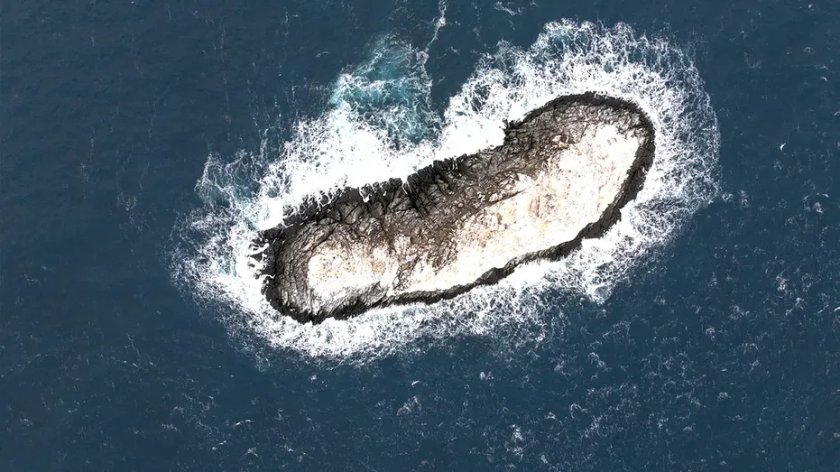
SouthernWorldwide.com – A previously uncharted island has been discovered in Antarctica, long marked as a “danger zone” on nautical charts, with researchers now mapping it for the first time.
The discovery was officially announced in April through a press release issued by the Alfred Wegener Institute (AWI), a prominent German research center specializing in polar studies. The institute is based in Bremerhaven.
This newly identified island is situated in the northwestern part of the Weddell Sea. Its discovery occurred during an expedition conducted aboard the AWI’s icebreaker vessel, the Polarstern.
The expedition’s primary objective was to study the significant and rapid decline of sea ice in the region. However, severe weather conditions forced the researchers to temporarily halt their work and seek shelter.
They found refuge on Joinville Island, aiming to escape the harsh winds and rough waves. It was during this unexpected pause that they spotted the previously unidentified island.
Simon Dreutter, an engineer specializing in bathymetry data at AWI, stated in a released comment that the nautical chart indicated an area with “unexplored dangers to navigation” along their planned route. He noted that the exact nature or origin of this information was unclear.
After reviewing available coastline records, Dreutter observed what he initially thought was an “iceberg that looked kind of dirty.”
He further recalled that upon closer examination, the team realized it was likely composed of rock.
The researchers then altered their course and proceeded in the direction of the object, and it became increasingly evident that they were encountering an island.
Upon approaching the island, the research team conducted a circumnavigation. They meticulously surveyed the seabed using an echo sounder and employed drone imaging technology. This marked the initial survey and recording of the region.
The island is approximately 426 feet in length and about 164 feet in width. Officials have stated that it rises about 16 meters, or 52 feet, above the water’s surface.
Authorities are still uncertain as to why the island was previously designated as a danger zone on maps. They have pointed out that from an aerial perspective, it bears a resemblance to surrounding icebergs.
A representative from the institute suggested that the reason might be linked to the presence of numerous uncharted shoals on the seafloor in the vicinity.
“Most areas are modeled from satellite data in low resolution,” the AWI representative explained. “Therefore, many areas, especially inshore and nearshore, can be considered white spots or gaps in the map. In consequence, also nautical charts only have a patchy data coverage.”
As the island has not yet received an official designation, it will now undergo a formal naming procedure. A proposal is slated to be submitted to the Scientific Committee on Antarctic Research (SCAR) for their review and consideration.
While the era of grand exploration may seem to be in the past, officials emphasize that less than a quarter of the Weddell Sea has been fully charted, indicating substantial potential for future discoveries.
“Since satellite observation, even in the remote areas of Antarctica, the discovery of an island is a rare and exciting event,” the spokesperson commented.
Read more : Liberal Elites' Outrage at America's State Fair
“But with only about a quarter of the Antarctic water charted, there is still a good scope for discovering landforms on the seabed.”